Valentia Island sounds so exotic; conjuring up images of sunny Spain in your mind not the rugged western point of the Iveragh Penninsula, Ireland. This corner of Ireland offers up dramatic scenery served with a slice of rural old world charm.
Valentia Island is a tiny island 7 miles long and 2 miles wide, with less than a thousand people living there. This close-knit community just off the Ring of Kerry is primarily a Gaeltacht, meaning that Irish is the predominant language here and the economy is mostly fishing and farming. There is a fair amount of tourism on Valentia Island because it is close to the UNESCO world heritage site Skellig Michael, and is also an extension of the scenic The Skellig Ring Road Drive. You can make Valentia Island part of your Skellig Ring Drive as we did, or explore it as a separate day trip from the Ring of Kerry.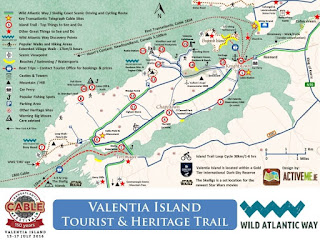
After visiting the two nearby Ringforts of Cahersiveen and the ruins of Ballycarbery castle "over the water" from Cahersiveen (which is what the locals call the area across the river from Cahersiveen), we decided to head to Valencia Island to check out the spectacular panoramic views.
There are two ways to get to Valencia Island the long Maurice O'Neill Memorial bridge that connects Valentia Island to the mainland at Portmagee or the short car ferry that takes you from Reenard Point just West of Cahersiveen to Knightstown on Valencia Island.
 |
| Boats At Reenard Point |
Valentia Island was perhaps named after its trading connection with Spain during the Middle Ages. The Irish name for this island is Dairbhre meaning "Oak Wood" as this was once home to a sacred grove of oak trees where the powerful blind Druid Mug Ruith once lived. He was one scary dude, and there are plenty of myths about him!
A fun way to get to Valentia Island is the small car ferry that takes the 1km trip back & forth (8:00-21:00) from Reenard Point to Knightstown. The car ferry costs €7 and operates from April to October, mainly hauling day-trippers back and forth to cute little Knightstown which is Valentia Islands main settlement located right on the waterfront. Stop in for a coffee at the charming little Knights Town Cafe on Market Street just up from the ferry dock. As of 2018, the cafe is under new management, and the cafe has completely turned around from its previous poor service/and overpriced food.
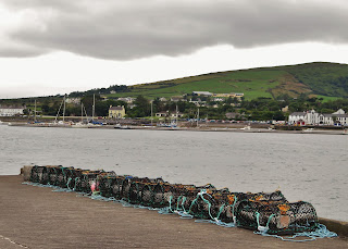 |
| Crab Traps At The Ferry Dock |
There are some really cool things to see on Valentia Island. One thing is the tetrapod trackways on the North side of the Island. There is a free parking lot at the trailhead that leads you down a short but steep path to the rocks. These prehistoric footprints were made by crocodile type critters that were the first creatures to come out of the oceans onto solid ground. The tracks were frozen in stone 365 MILLION years ago, and are some of the oldest signs of life on land!
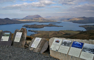 |
| Geokaun Mountain View Point |
Another place to visit is Geokaun Mountain, Valentia Island's highest point. You can hike up or drive to the summit for 360-degree views of the surrounding Iveragh Peninsula, Dingle Peninsula and Skellig Islands. It costs €2 for pedestrians or €5 per car entry fee, and there is a 1km peak walk with over 50 interpretive plaques that tell you about the history, myth, geography, flora & fauna of the area. There is also a viewing platform on the top of the 600ft Fogher Cliffs where you can get very close to the edge-don't worry there is a guardrail here. For more information go to www.geokaun.com.
 |
| Bray Head Trail |
Our main activity on Valentia Island that day was the hike to Bray Head that our Airbnb host recommended to us. The Bray Head Loop trail is an easy 5km (60-90 minute) walk that slopes upward from the parking lot to the Bray Head tower, then walks along the 700-foot cliffs before the trail turns inland once again, passing through pasturelands until you return to the car park. Many people just walk the 2km to the tower and double back to the parking lot. The car park costs €2, and there are picnic tables and a butt-hut here, which makes it a great rest stop. Because the weather systems are blowing in directly off the Atlantic Ocean, the conditions are continually changing. Wear a windbreaker or waterproof coat even in the middle of summer because it gets very windy on the cliffs. Also perhaps some sensible walking shoes since you are trudging through a pasture in the second half of the trail back to the car park.
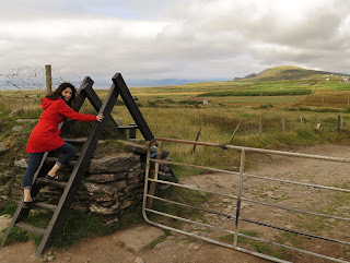 |
| Stile Over Stone Wall At Bray Head |
"We have travelled many miles, over hedges and stiles"... goes the traditional Christmas carol. Stiles are ladders that climb over fences, and there are A LOT of dry stone fences in Ireland. These fences use no mortar to hold the stone together, just gravity. Dry stone fences are a common sight in Western Ireland, and if you want to learn more about this ancient farming tradition and where to see the best stone walls in Ireland see dochara.com there's lots of information on all things Irish there!
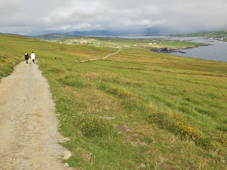 |
| The path to Bray Head Cliffs |
The "hike" to Bray Head is more of gentle 2km walk up the slope to the cliff head. Once up top, there are sharp drops off the cliffs with NO GUARDRAILS! Keep a close eye on children.
 |
| Remains Of Drystone Beehive Huts |
Watch for the remains of some ancient beehive huts to your right as you wander up to the Bray Tower and the cliffs. These huts were built with the dry stone technique common in the Bronze age on the Skellig Coast and were probably associated with the monastery on Skellig Micheal (the islands on the horizon in the picture). There are also 12 "decorated stones" in the field here with early Christian crosses and Pagan geometric symbols, confirming this was a monastery site.
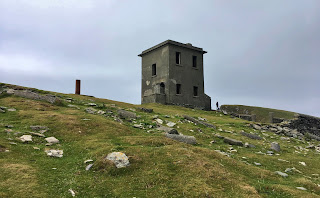 |
| Bray Tower |
At the top of Bray Head is the remains of an abandoned two storey tower built in 1815 by the English army during the Napoleonic Wars. This tower was part of a system of towers along the west coast of Ireland and was in use until the end of WWII. I had fantasies of buying it and opening a fantastic B&B here...who can say "hot tub off the veranda?"
 |
| Cliffs of Kerry From Bray Head |
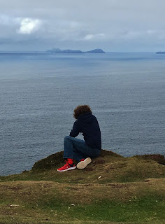
The cliffs are an abrupt drop, but if you sidle up to the edge and look down, you may see some wild goats or "pucks" roaming around on the rock ledges. In the photos, they look like little white dots, but they are definitely wild mountain goats!
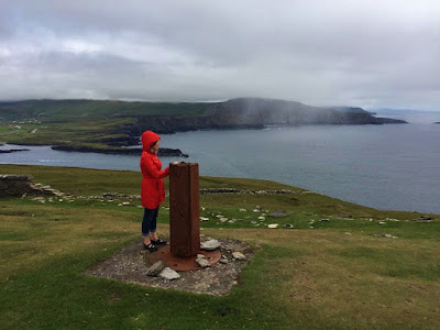 |
| View Of The Skellig Coast |
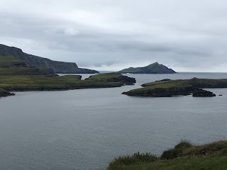
It was interesting to watch the weather systems come in off the Atlantic; sun, wind, rain, repeat! We also watched the Skellig Island tour boats coming back to Portmagee from their trip to the famous Skellig Micheal. It was sobering to think the next stop past the Skellig Islands is North America!
 |
| Returning From Skellig Micheal |
To complete the Valentia Island Ring, head over to the R565 (which is the Skellig Ring Road) from the Bray Head car park.
This takes you past Foilhommerum Bay where the first ever transatlantic telegraph cable was laid in 1865 connecting Europe to Newfoundland, Canada. Continue along the road until you get to the bridge that crosses Portmagee Channel. Next to the bridge is the Skellig Experience Visitor Centre where you can learn about the history, archaeology and wildlife of Skellig Islands.
 |
| Bridge To Portmagee |
The Skellig Visitor Centre is a great place to visit before your boat tour to the Skellig Islands, or as a consolation activity if your boat landing tour to Skellig Micheal is cancelled due to bad weather. Crossing over the Maurice O'Neill Memorial Bridge, you end up at Portmagee's marina. This is marina is where the Skellig Michael boat tours leave from. If you want to stop for a bite to eat, a pint or a lovely cup of tea in Portmagee, I recommend the Fisherman's Bar right across the street from the Marina. It's the place the locals recommended to us, and it was the perfect end to our Valentia Island Ring drive!
Sweeping views and rugged coastal terrain are the hallmarks of Ireland's Skellig Coast. Valentia Island has them both and so much more to offer in history, culture and nature. I hope you get out, and explore it too!
Follow me on FACEBOOK, INSTAGRAM and BLOGLOVIN' for daily photos and updates! #slowtravel🐌 #dulgomall



No comments:
Post a Comment