Translate

Showing posts with label Adventure. Show all posts

Friday, June 13, 2025

Hidden Umbria: Civita di Bagnoregio


Civita di Bagnoregio, Lazio, Italy


Somewhere between Ghost Town and Fairy Tale Village floats Civita di Bagnoregio.  Referred to as "the Dying Town," Civita di Bagnoregio is a medieval wonderland lost in time...


Civita di Bagnoregio over the Valle dei Calanchi, Lazio, Italy
Central Italy has no shortage of off-the-beaten-path hill towns to discover.  The Provinces of Tuscany, Umbria and Lazio meet at the Valle dei Calanchi or Valley Of The Badlands and is home to one of Italy's most beautiful villages, Civita di Bagnoregio.  Civita is situated about 24 km to Orvieto in Umbria, making it a perfect day trip.  Full of Medieval architecture, smack in the middle of a stunning canyon and Civita di Bagnoregio is completely car-free. 

Italian Poet Fillipo Paparazzi once wrote that Civita di Bagnoregio was "an island bravely poised in the middle of the air, on the top of a truncated cone, above the immense abyss..."
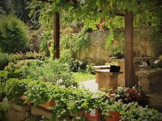
Maria's Garden, Civita di Bagnoregio, Lazio, Italy
Maria's Garden

Built upon a foundation of tufa upon clay that is slowly eroding with every passing year, Civita di Bagnoregio was founded by The Etruscans over 2,500 years ago. Like the town of Pitigliano, the Romans took over in 265 BCE and renamed the settlement Bagnoregium.  Much of the town has already slid into the canyon below after a massive earthquake, and the residents moved across the ravine to the modern city of Bagnoregio.  There are less than 20 permanent residents living in Civita di Bagnoregio today. Most of the well-cared-for homes in the village are weekend escapes for city folks.  There are more cats than inhabitants lounging in the shady gardens.  

Map of parking lot for Civita di Bagnoregio, Lazio, Italy

Getting to Civita di Bagnoregio which lies two hours north of Rome, is simple.  The closest large town to Civita is Orvieto in Umbria.  There are busses leaving from Orvieto to the Bagnoregio bus station several times a day, and then it's a 20-minute walk to the bridge that crosses the canyon to Civita.  Alternately, there is a shuttle bus during tourist season that leaves the Bagnoregio bus station and drops you at the bridge crossing.  If you arrive by car, drive through Bagnoregio's main street following the yellow street signs to Civita di Banoregio's metered parking lot.  There is a booth where you can pay to cross the footbridge (in 2026, it is €5),


Pedestrian footbridge to Civita di Bagnoregio, Lazio, Italy

Porta Santa Maria the entrance to Civita di Bagnoregio, Lazio, Italy


A pedestrian footbridge stretches across the vast canyon, leading upward to the Roman archway, which is the village's entrance.  Stepping through the Porta Santa Maria arch, you walk along the Etruscan road that was carved 2,500 years ago.  These ancient cobbled roads had led to Rome before Rome WAS Rome!


Civita di Bagnoregio is a delightful place to spend an afternoon-WITH NO AGENDA.  

Remains of Etruscan carvings on the side of a building in Civita di Bagnoregio, Lazio, Italy

There are no main sights to see in Civita di Bagnorgio. The delight is to stroll the hamlet, take a million pictures, have lunch & a coffee and perhaps stop to pet the many, many cats here.  The village is tiny, so it doesn't take long to wander around it.  Enjoy the Etruscan carvings, the medieval layout of the town, the remains of the renaissance palace. Find the outdoor laundry sinks, where the locals have been meeting for decades.

Church of San Donato on the main piazza of Civita di Bagnoregio, Lazio, Italy


On the main piazza, check out th
e church of San Donato.  You will notice round columns in front of the church. These were once the foundation of an Etruscan temple, then a Roman temple and finally a Christian cathedral.  Take a moment to peek inside the church to admire the beautiful and haunting 15th-century crucifix carved out of pear wood.  


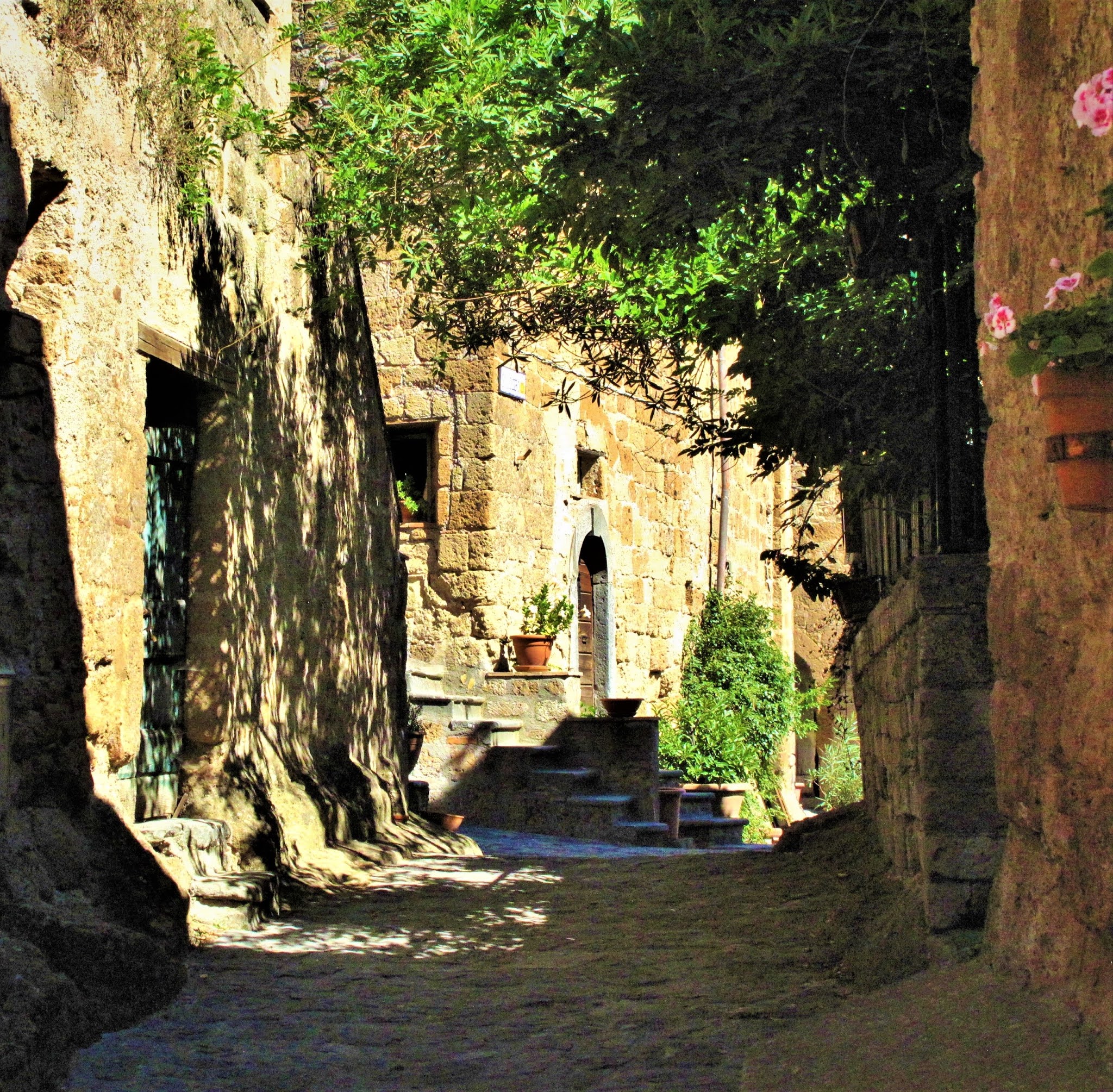
Ancient alleyways of Civita di Bagnoregio, Lazio, Italy


As you stroll the village and take in the views, wander the small alleyways, admire the display of flowers that explode from every window box and staircase.


Etruscan caves in Civita di Bagnoregio, Lazio, Italy


At the end of the town, the main street begins to slowly wind downhill. The road eventually turns into a trail that villagers used to travel to attend their farms on the valley floor.  If you descend along the pathway, you begin to see caves carved out by the Etruscans 2,500 years ago!  These caves were used as wine cellars and storage for farm equipment until just a few decades ago. 


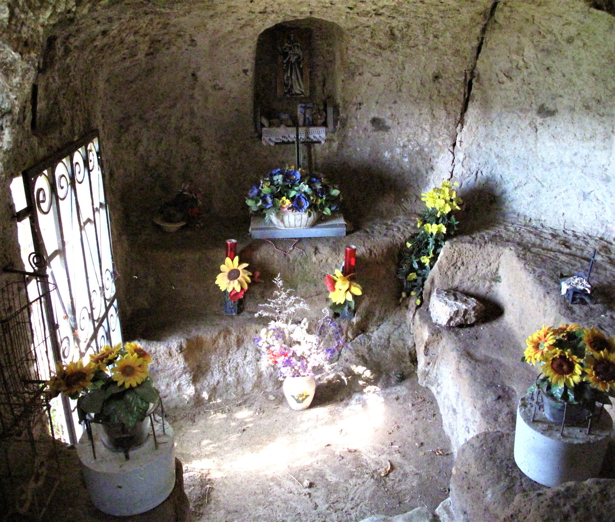
Cappella del Carcere, Chapel of the Incarcerated, Civita di Bagnoregio, Lazio, Italy

One cave has a gate in front of it, sealing it off, but you can peer inside.  This is the Cappella del 
Carcere or The Chapel of The Incarcerated.  This was most likely an Etruscan tomb, but in Medieval times it was used as the city's jail.  This humble "chapel" is a special place of worship for the few remaining Civita residents and is the town's starting point for religious processions.  Now that you have worked up an appetite exploring Civita, it's time for a meal!


Having lunch outdoors with street cats in Civita di Bagnoregio, Lazio, Italy

There are many choices for food in Civita.  I decided to stop for a delicious lunch at a small Osteria off the main piazza called La Cantina di Arianna. Delicious "bruschetta" (toasted bread with local olive oil) and homemade salumi, and of course, the local Orvieto Classico white wine is the best!  Check out my blog post for more information on Wines to Try in Umbria.  My son had so much fun feeding the cats and their little kittens that gathered under our table during lunch.  It seems like outdoor dining in hill towns often means you will have little furry guests joining you for your meal.


Potted plants at a home in Civita di Bagnoregio, Lazio, Italy


Civita di Bagnoregio had soared in popularity since I first visited it in 2013 when it was just a sleepy little ghost town on the Tuscan-Umbrian border.  I recommend planning your visit to Civita earlier in the day or later in the evening, catching the sunset, to avoid the mass tour-bus crowds.  Just remember to slow down your pace and enjoy sauntering around this unique place on earth.

Have you been to Civita?  What was your impression; a tourist trap or a slice of heaven?  Let me know in the comments below!


Follow me on FACEBOOKINSTAGRAM  and  BLOGLOVIN'  for daily photos and updates! #slowtravel🐌

Saturday, February 13, 2021

Castiglione Del Lago~Perfect Family Destination In Umbria

Lake Trasimeno from the ramparts of the castle in Castiglione Del Lago, Umbria, Italy

Looking for a hidden family-friendly gem in Tuscany?  This peaceful lakeside town on the Tuscan border with Umbria has all the charms of a big resort, without any tourist crowds.


As a lover of "Slow Travel," I like to stay in one location for at least 3 days and explore the surrounding area.  On my visit to Tuscany, my small family rented part of a farmhouse in Cortona and made day trips to many destinations in Tuscany.  For great tips and Italy road-trip planning advice, read my blog post on: Tuscany Road Trip

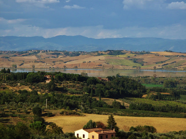
View of Lake Trasimeno and farmlands from Cortona, Tuscany, Italy
Castiglione Del Lago Viewed From Cortona

It was a sweltry mid-September day in Tuscany, and it also happened to be my birthday, so nothing was planned on my travel itinerary.  I decided to be spontaneous, go on an adventure and find somewhere not listed in the guidebooks.  Looking at the map book, I decided to head for Lago Trasimeno to beat the heat.  
Castiglione del Lago looked interesting and only 20 km from Cortona, featuring an ancient castle jutting out into a lake.  So I set our rental car's GPS, pressed go, and we were there less than half an hour later.


Medieval city gate in Castiglione Del Lago, Umbria, Italy
Gate in Medieval Wall


Castiglione del Lago is on the West side of Lago Trasimeno just across the Tuscan border in Umbria; Lake Trasimeno being the dividing line between Tuscany and Umbria.  The village of about 15,000 people today started as a castle on an island.  Over time as the city grew, the flat area between the castle and the shore was reclaimed and filled in with buildings and piazzas.  The town's well-preserved historical centre or centro storico is surrounded by a Medieval wall.  Castiglione del Lago's old town centre is known for its threes, meaning there are three city gates, three parallel streets (which is a Roman-era city layout), three piazzas and three churches.  The main sights in this charming town are the castle and the palace, but there is also a public park with a beach and free parking just to the north of the castle on Via Lungolago.  


Map of the historical center of Castiglione Del Lago, Umbria, Italy


Baskets of bulk food shopping for local products in Castiglione Del Lago, Umbria, Italy
The Centro Storico of Castiglione del Lago is within the Medieval walls and completely car-free, making it a delight to stroll.  
There are several free and paid parking lots along Via Belvedere, the road that circles the Old Town.  I also found much free street parking just outside the walled city centre.  Most visitors enter Castiglione del Lago through the West Gate, the Porta Senese and wander along the main street, Via Vittorio Emanuele.  Here you will find a gauntlet of stores selling Prodotti Tipici or regional products like local cheeses, kinds of dried pasta, beans, spices, sweets, and olive oil.  
I loaded up on dried pici, a local thick hand-rolled pasta.  For more on local Tuscan products, read my blog post on: 10 Things You Must Eat In Tuscany


Alter inside church of Santa Maria Maddelena in Castiglione Del Lago, Umbria, Italy
photo: Wolfgang Sauber
The main drag heads East towards the Lake, passing by the beautiful Church of Santa Maria Maddelena, with its neo-classic columns out front and Greek cross plan.  It's worth the peek inside to see the painted panels from 1580 and the lofty dome.  This church was once a Roman Temple when the Romans founded the city and was given the name Clusium 
Novum or New Chiusi.  Chiusi is a lovely Tuscan village and was an important Etruscan city located nearby.  To read about Chiusi, see my blog post: Chiusi Tuscany~Under The Etruscan Sun
Corridor connecting the Palace and the Fortress of Castiglione Del Lago, Umbria, Italy
Corridor to the castle
Following Via Vittorio Emanuele, you come to a grand Renaissance palace, the Palazzo della Corgna. This palace was built for the Duke della Corgna and serves as the city hall, civic museum and art gallery.  There are some beautiful frescoes in the palace, but the real fun is taking the long covered corridor to the Medieval star-shaped castle called the Rocca de Leone.  The castle was completed for Frederick II of Swabia in 1247 by the monk/architect Brother Elia.  Elia was a Franciscan monk from Cortona, who happened to be Saint Francis of Assisi's best friend and right-hand man.  For more information on Saint Francis and the shaping of Umbria, check out my blog post: St. Francis the Umbrian Rock Star!   

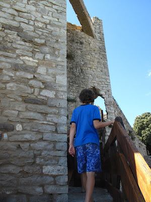
This long walkway leads you to a wonderfully restored stone fortress with sweeping views of Lake Trasimeno, the lake's islands, and Cortona climbing the distant mountainside.  Kids can have fun exploring the ramparts, climbing the tall three-sided bastion tower called "the masio," or take in the shade of the olive trees in the castle's bailey.

View of lake Trasimeno and Rocca de Leone from the "Masio" tower, Castiglione Del Lago, Umbria, Italy
View From The Masio
Climbing the towers and ramparts of Rocca de Leone in Casliglione Del Lago, Umbria,  Italy
Exploring the ramparts of Rocca de Leone castle in Castiglione Del Lago, Umbria, Italy
Strolling under the shade of the ancient olive trees along the ramparts of Rocca de Leone castle of Castiglione Del Lago, Umbria, Italy
If you have worked up an appetite from exploring the fortress, many excellent local Osterias serve local specialties from Lake Trasimeno.  Look for a dish called Brastico, which is fish fire-roasted over reeds from the shore of Lake Trasimeno.  Or perhaps try Tegamaccio, a soup made with several different types of lake fish, baked in terracotta pots for five hours.  Alternately you can grab some take-out food such as panini (sandwiches), arancini (deep-fried rice balls stuffed with meat and or cheese) or pizza sold by the gram and head to the public beach for a picnic.  The beach at Castiglione Del Lago is sandy; the water is warm, clear and shallow, perfect for kids to cool off on a hot day.  The lake water is tested daily from April through September to make sure it is safe for swimmers.

Sandy public beach park of Lake Trasimeno at Castiglione Del Lago,  Umbria, Italy

Family time in Tuscany has never been so much fun!  What is your favourite family activity when visiting Tuscany?  Let me know in the comments below...


Follow me on FACEBOOKINSTAGRAM  and  BLOGLOVIN'  for daily photos and updates! #slowtravel🐌


Sunday, August 23, 2020

Saturnia Hot Springs, Tuscany

Old mill at Gorello Fall, Saturnia, Southern Tuscany, Italy


Tuscany is blessed with numerous thermal baths, known as "terme" in Italian.  Hot water springs from deep within the Earth, holding healing properties that make this area of Italy a paradise for spa lovers.

Warm water cascade of Gorello Falls, Saturnia, Grosetto Province, Tuscany
The Maremma region in Southern Tuscany is dotted with delightful thermal waters, resulting in both natural outdoor pools and spa resorts.  Southern Tuscany's sulfuric Terme waters also boast some of the most healing properties in all of Italy.  One of the best places to experience Terme in Tuscany is the quiet village of Saturnia, located in the deep south of Grosseto Province, near the border with Lazio.  

The settlement at Saturnia was called Aurinia by the Etruscans. A settlement has existed here since pre-Etruscan times and is thought to be one of the oldest cities in Italy, most likely due to the abundance of thermal springs.  There are Pre-Etruscan tombs in the area, like the Necropoli del Puntone (1 KM North of Saturnia on the road to Poggio Murello) that establish Saturnia as a Pelasgi settlement which was the region's indigenous people.


Roman gate on the Via Clodia, Saturnia, Grosetto Province, Tuscany

Etruscan and Roman structures around the village of Saturnia include the Etruscan walls, dating back to the 3rd and 4th centuries BCE, which incorporate the "Porta Romana," a Roman-era city gate.  The Via Clodia, a Roman road that leads to the Porta Romana, was built on an existing Etruscan Route linking Pitigliano, Sovana and Sorano, incorporating some of the mysterious Via Cave.  Check out my blog posts on these nearby attractions.  There are also remains of the ancient Roman baths at the far end of town on Via Italia.  There is also a picturesque castle in Saturnia called the Rocca di Saturna or Castello Ciacci by locals.  This was an Aldobrandesca Fortress built in the 1100s along the fortifying city walls by the original rulers, the famous Aldobrandeschi family of Sovana.  While in Saturnia, be sure to visit the small but interesting archaeological museum. 

The name Saturnia came from the Romans, who settled this area in 183 BCE.  Legend has it that the Roman God Saturnus (Saturn) was tired of the constant warring among humans in the area.  In a rage, Saturnus threw a thunderbolt from the heavens down to Earth, and where the thunderbolt stuck, a magical spring of warm water was created to pacify humankind.  This is the main attraction of Saturnia today.


Cascade of thermal waters at Cascatelle del Mulino, Saturnia, Grosetto Province, Tuscany, ItalyThere are two terme areas in Saturnia, a posh hotel spa and a natural thermal waterfall;  both of these originate from the same source.  The Terme di Saturnia Natural Spa and Golf Resort is a 124-room Five-Star hotel resort for those who want to pamper themselves.  You can book a full-day (€29) or half-day package (€25) at the resort without having to stay overnight in the hotel, which is an excellent alternative to the busy free hot springs.  Check out the resort website at termedisaturnia.it and navigate to the "Reservations & Gift Vouchers" section at the top right of the homepage to book a day package.

The more popular destination attracting locals and tourists alike is Gorello Falls.  An ancient stone mill sits atop Gorello Falls, also known as "Cascatelle del Mulino," or Miller's Falls, to the locals.  This is where one can sit outside in a cascade of warm water...  FOR FREE!!! 

Crowded Sunday afternoon at Gorello Falls, Saturnia, Grosetto Province,Tuscany, Italy
Gorello Falls can be a hectic place, even in the offseason.  Follow the Strada Provinciale SP10 south from Saturnia towards Montemerano for about 2km, and you will see signs for the falls.  There are two parking lots for the springs, both are free.  The first and closest option is a large dirt parking lot at the end of Via della Follonata, which can be quite rough in spots where there have been seasonal washouts.  The overflow parking lot is also located on the SP10, just past the falls, and is a slightly farther walk to the springs. 

I visited Gorello Falls on a Sunday afternoon in late September, and the place was absolutely packed! Robust Russians were padding around in bathrobes, sexy Italian couples on their Vespas, German families camping out in Westfalias, and even locals with horses tied up in the shade of the treed parking lots!  It was a smorgasbord of people watching, and everyone was having a wonderful time.


Saturnia natural hot springs, Grosetto Province, Tuscany, Italy

You can smell the water before you see it; the slightly sulfuric scent emanates from the healing waters, which are at a perfect temperature of between 37 °C and 38 °C.  Cobalt blue calcium-rich water cascades down layered basins of smooth, white limestone at a rate of 800 litres per second.  Each of the little pools can hold about 3-5 adults quite comfortably.  Sitting in one of these stacked pools gives you the feeling that you are a giant pigeon in a warm Italian fountain!  The healing properties of the water are said to help cure vascular diseases and ease muscle tension and pain.  The mineral-rich black mud found at the bottom of the falls is known to alleviate skin disorders such as eczema and psoriasis, so it's common to see people smearing the dark clay all over their faces and bodies.  Remember, there are no storage facilities available at Gorello Falls, so please lock all your valuables in the trunk of your car and bring only your towel to the falls.


Cascate del Mulino, Saturnia, Grosetto Province, Tuscany, Italy
Gorello Falls In The Evening
Further upstream behind the old mill, the hot water runs in a swift-moving channel.  Older kids can ride the stream like a waterslide, but keep your eye on smaller children who can easily be swept up in the swift-moving current.  Even further upstream, there are spots where ropes are tied across the narrow river channel just below the water surface, which are not visible to the eye; be cautious not to get hung up on them!  

The best times to visit Cascate del Mulino during the busy tourist season, from April to October, are early in the morning, before 10:00 a.m., or in the evening, after 5:00 p.m.   There is a cafe/bar located near the falls that serves hot and cold snacks, sandwiches, gelato, and desserts, as well as beer and cold beverages. The cafe also provides shower and washroom facilities.  The Bar Cascate di Saturnia opens daily at 8 am and closes late. 

UPDATE: MARCH 2025- The restaurant Bar Cascate di Saturnia was closed for renovations, but the toilets/changerooms attached to the bar remained open.  You can access these from outside the bar.


Saturnia's hot springs have something for everyone, from elegant spas to free family fun, to romantic midnight dips under the moon and a blanket of stars❣

Have you visited Saturnia, Tuscany?  Which Terme did you prefer: the Spa or the free natural springs?  Let me know in the comments below.


Follow me on FACEBOOKINSTAGRAM  and  BLOGLOVIN'  for daily photos and updates! #slowtravel🐌


This post first appeared in September 2013 as Saturnia Tuscany; Saturn's Bathtub 

Friday, July 31, 2020

Tuscany's Mysterious 'Vie Cave'~"Streets Of The Dead"


Shaded canyon of the San Rocco Via Cava near Sorano, Tuscany, Italy


The Etruscan civilization is a mystery to historians and archeologists alike.  Some of the baffling remnants of their culture are the subterranean roads called the Vie Cave, or the 'Sunken Roadways' are 'Streets of The Dead' leading to ancient necropoli...


Decending the switch-backs of the San Rocco Via Cava near Sorano, Tuscany, Italy

There are ancient excavated roadways all across Spain, Italy, Turkey and into the Middle East in as far away places such as Isreal and Jordan.  The "roads"  were constructed by different civilizations and for various purposes. In Jordan, for example, channels were carved into the rock to direct water to ancient cisterns.  In Southern Tuscany, these excavated or "sunken" roads are called Cavoni or also Vie Cave.  These pathways were hand chiselled into the volcanic tufo rock, and are much older than once thought by archeologists.


Local trail map of the San Rocco Via Cava walk near Sorano, Southern Tuscany, Italy
The Vie Cave are called 'Tagliate Etrusche' or 'Etruscan Cuts'  by the locals and is attributed to being carved by the ancient Etruscans.  They are now thought to have been constructed by the Iron-Age Villianovian Civilization, the earliest of the Etruscans. The Villianovians lived in Southern Tuscany and Umbria in about 900-700 BCE. However, the Vie Cave could be much older than that.  Much speculation on what the purpose of the Vie Cave was; for directing rainwater into cisterns, as defensive measures against attack o. perhaps,  for ceremonial purposes.  The Romans later incorporated the Vie Cave into their roads system to form part of the Via Clodia that linked Rome with Manciano in Tuscany, which was a vital farming region for the Empire.


Early Christian carving in a cave of the San Rocco Via Cava near Sorano, Tuscany, Italy


These trails that were hand-carved into the rock are commonly known in Italian as 'Vie Sacre' or 'Sacred Pathways.'  Many of the Vie Cave lead from village centres to Etruscan Necroploi or "cities of the dead." There is a theory that the dead were not transported above ground; instead, they were carried through the subterranean Vie Cave to a Necropolis for cremation and burial.  Through the centuries,  Early Christians left religious symbols on the Vie Cave. Christian symbols were also carved into the Etruscan tombs, and many early churches were built alongside the Vie Cave.


Shaded canyon of the San Rocco Via Cava near Sorano, Tuscany, Italy


Hiking trails in Southern Tuscany are plentiful, with day-long and multi-day journies through every type of terrain.  There are around 15 Vie Cave in the Southern Tuscan area linking the hill-top towns of Pitigliano, Sovana, Sorano, San Quirico, the lost city of Vitozza and San Valentino with its ghost town.  Hiking a shady Via Cava (singular for Vie Cave) is a pleasant and refreshing walk in the heat of the afternoon Tuscan sun.  The Vie Cave canyons can get up to 20 meters deep and up to 3 meters wide, typically following a river bed.  Take great caution when walking the Vie Cave, for they are on the World Heritage Watch List for endangered monuments because of their fragile nature.  The rock is so soft and easily eroded by water and flooding.  Look for the ancient chisel marks of the Etruscan carvers still visible in the Via Cava stone almost three thousand years later!


Viewpoint overlooking Sorano, Southern Tuscany, Italy


I discovered the Vie Cave when exploring the Southern Tuscan village of Sorano.  After spending the night in a Medieval castle high above Sorano, we were driving to the natural hot springs in Saturnia.  Travelling along the SP22 regional road, we saw a roadside viewpoint about 2 km outside of Sorano. Here, you will find a gorgeous view of Sorano across the Lente River canyon.  This was also the trailhead for the San Rocco Via Cava that descends slowly down to the Lente River, winds around the base of Sorano and ends in Vitozza about a 3 hours walk away.


Cave near the San Rocco Via Cava trailhead, Tuscany, Italy

The San Rocco trailhead has plenty of parking, a cliff-side viewpoint with a stunning panorama of Sorano, a few picnic tables and is an enjoyable spot to stop for lunch.  There are also some cave dwellings to explore here.  Follow the signs behind the site of the early church of San Rocco to the trailhead of the San Rocco Via Cava.  Signage and maps explain the history of the Vie Cave in Italian and English at the start of the trail.


Trailhead of the San Rocco Via Cava near Sorano, Tuscany, Italy


Until 1940 the San Rocco Via Cava was the only road leading from Sorano to Sovana!  The Via Cava trail leads gently downwards through a forest full of Oak and Black Walnut trees.  There has been some restoration of the Via Cava walls, and as you descend to the river, the canyon walls grow higher and higher.  A sturdy pair of walking shoes and some bug spray are recommended. However, in late September, when we visited, there were no mosquitos.


Columbariums of the San Rocco Via Cava near Sorano, Tuscany, Italy

Other unique features along the San Rocco Via Cava and around the Sorano area are the Columbarium.  A columbarium or dovecote are caves with rock-cut cells all lined up over top of each other like modern-day cubby holes!  These columbariums were used for housing doves and pigeons in Roman times all the way up to the Middle Ages. Although these dovecotes are much older than that.  I think the dovecotes were Etruscan columbariums used for human ashes. Much like our modern columbariums in cemeteries today, these caves were "cities of the dead" or necropoli. The early Etruscan's funerary practices involved cremation, which later changed as they exchanged cultural information with other advanced societies that moved into their territories, such as the Greeks and Romans.

Shaded canyon of the San Rocco Via Cava near Sorano, Tuscany, Italy


There are surprises to discover at every twist and turn along the San Rocco Via Cava, including many caves, cliffs and necropoli!


Have you walked any Vie Cave; which one?  I would love to hear about your experience in the comments below!


Follow me on FACEBOOKINSTAGRAM  and  BLOGLOVIN'  for daily photos and updates! #slowtravel🐌


Wednesday, June 17, 2020

Chiusi, Tuscany~Under The Etruscan Sun

A view of Lake Chiusi from the cathedral of Chiusi's  belltower, Chiusi, Province of Siena, Tuscany, Italy
A small Tuscan hill town built on a massive tufa foundation; Chiusi's attractions are all below ground!  This charming country village holds a secret under its streets...

Chiusi's Piazza Duomo and the Cathedral of Saint Secondiano, Chiusi, Province of Siena, Tuscany, Italy

For Tuscan adventure seekers, this small somewhat off the beaten path hill town, Chiusi (pronounced choosy) is a troglodyte's dream. At one time, this hilltown was an ancient Etruscan hub and one of the most important cities in Etruria.  Building upon a broad tufa rock foundation allowed the Etruscan people to easily dig a network of tunnels used to store wine, collect rainwater or to escape when under attack.   The Etruscan name for Chiusi was Clevsin, and it was constructed and settled by pre-Etruscan people dating back to the 8th century BCE.  Clevsin was built upon an Etruscan trade route to Rome, later becoming the Via Cassia.  The Via Cassia branched off from the Via Flaminia that lead to Umbria, and Clevsin became a Roman town called Clusium.

Separate belltower of Cathedral Saint Secondiano, Chiusi, Province of Siena, Tuscany, Italy


Chiusi is located close to the border of Umbria and Lazio in the south of Tuscany. It is located along the A1 autostrada between Florence and Rome, and many trains stop or change in Chiusi, making it a transportation hub.  If you are driving your own car, parking lots near the historic centre are plentiful, and many are free.  Try the convenient parking lot off of Via della Pietriccia just behind the town's main square.  TIP: If you are planning to see several sights in Chiusi, I would recommend purchasing the Chiusi Museum Card to save on entrance fees.  The pass costs €10 and allows admittance to all 3 Chiusi museums.
There is an excellent archeological National Etruscan Museum just off the piazza.  There is an extensive collection of Etruscan artifacts and funerary urns.  You can also arrange visits to the local Etruscan tombs such as Tomb Of The Pilgram and Tomb Of The Monkey. These tombs are located just outside the town, which requires a guide to tour.  The museum entrance fee is €6, and visiting the tombs is €2 and requires advanced reservations.


Close uo of the underground Etruscan carved well far below the streets of modern Chiusi, Province of Siena, Tuscany, Italy


While this quaint village is pleasant enough to wander around for the day, the real attraction is Chuisi's underground caverns.  The Chiusi Civic Museum "The Underground City" on Via II Ciminia offers tours several times a day of the City UNDER the City.  Knowledgeable guides take you on a one-hour underground Etruscan city tour of the tunnels, subterranean wells and lakes that were the Etruscan water system network for the large city of the time.  Your guide either takes you to the underground lake or the hand-carved well, both were vital water sources to the ancient city with 25,000 residents.
A room full of ancient ossuaries in Chiusi Underground Tour, Chiusi, Province of Siena, Tuscany, Italy
If you don't manage to visit the museum, the Underground City tour has an extensive collection of Etruscan ossuariesAn ossuary is a carved stone box or funerary urn where human remains are placed.   The ossuaries were found in the nearby necropolis located out of town.  A necropolis is literally a city of the dead where all the ornately carved ossuaries are placed.  When someone died, an enormous banquet was held, and many of the ossuaries depicted the dead feasting.  The Etruscans used to cremate their dead, but then as Roman culture became popular, inhumation became the fashion.  

Ancient Etruscan ossuaries or funeral urns underground in Chiusi, Province of Siena, Tuscany, Italy


So fascinating! We were shown how to read the Etruscan names on the ossuaries, from right to left.  It was interesting that the most popular female Etruscan first name was Tania!  Many of the wealthy Etruscans had depictions of themselves carved on top of the ossuary.   The departed loved-one appears propped up on one elbow as if eating during a banquet feast,  a tradition that the Romans later adopted.
The Greeks, who were at war with the Etruscans and settled in this part of Italy, also had a high impact on the Etruscan culture.  The Greek God Dionysus was reflected by the Etruscan wine God named Fuflun, who is depicted on many of the ossuaries.


Children love the underground city tour in Chiusi, Tuscany, Italy
The Cathedral of Chiusi offers another underground tour.  The Cathedral of Saint Secondiano or Chiusi's Duomo was built in 560 CE over a Roman Temple, which was converted from an Etruscan Temple.  The Duomo's bell tower, which stands separately, was built over a Roman swimming pool that was in use in the first century BCE.

To sign up for this tour, you must go with a registered guide.  Buy the tickets at the Duomo museum. The Museum entry fee is €2, the underground tour is 3, a combo ticket is 4.  The tour was in Italian, and our guide didn't speak much English, but he was accommodating.  We followed the guide outside to access the underground labyrinth through a secret door at the back of the cathedral.  Once again we travelled deep underground through a maze of tunnels.  If you are claustrophobic, this tour IS NOT the right choice for you.  Also, some of the passageways are very narrow, and the robust Italian family that was taking the tour with us had to turn back because one person in their party could not fit through the thin tunnel.  

Underground Roman cistern now sits under Chiusi's Duomo, Chiusi, Province of Siena, Tuscany, Italy


The guide expertly leads you through a literal maze of passageways that were carved out of tuff stone over 2000 years ago.  The underground tunnels are dark, cold and eerily quiet.  After about 20 minutes, you arrive
at an enormous cistern located directly under the courtyard of the church.  This was once a Roman swimming pool. I learned one of my favourite Italian words, "pipistrello," which means bat!  There was a colony of bats living in the cistern. A few of them were flying around, disturbed by the flashlights and our voices.  


Staircase from the underground cistern to Chiusi's  belltower, Chiusi, Province of Siena, Tuscany, Italy


The guided tour ended by having the chance to climb all the way up the bell tower of the church.  It must have been hundreds of stairs!  Climbing the spiral staircase from the still, dark, cold of the cistern into the bright, searing heat of the afternoon felt like a metaphor of some sort.  The views from the belltower are expansive, and one can see all the way to Lake Chiusi nestled amongst the rolling hills.

We definitely earned our gelato today!

I felt the need to find out more about the Etruscan civilization after exploring Chiusi above and under the ground.  Maybe a visit to the Etruscan museum in Cortona is to find out more about these mysterious ancient peoples and their fascinating customs that seemed to have disappeared into the mists of time.  

Chiusi sparks my curiosity about ancient Italian civilizations and beckons me to explore deeper ...underground!

Follow me on FACEBOOKINSTAGRAM  and  BLOGLOVIN'  for daily photos and updates! #slowtravel🐌