Ringforts or "Cahir" in Irish, are mysterious remnants of Ireland's unique Celtic past. The stone forts are connected to the land by history, myth and legend. Hidden away off the Ring Of Kerry, there are ancient stone ringforts you can have all to yourself to explore!
 |
| Crossing the Bridge at Cahirciveen |
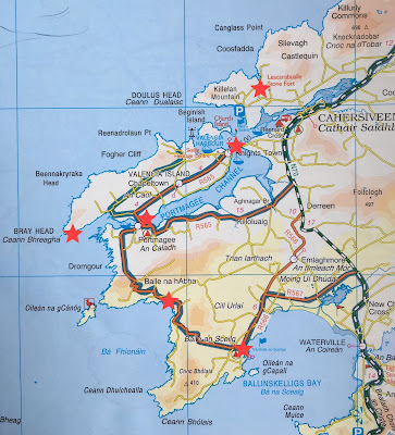 |
| Ringforts Are Labeled At The Top In Red |
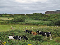
Once you cross the river, you continue straight on to the next crossroads which is Castlequin Road and then turn left following the signs towards the Ballycarbery castle. The stone forts are about two miles up the road, and they are within walking distance of each other. There is a free parking lot on Castlequin Road and a clearly marked path lined with fragrant honeysuckle leads you along cow and sheep pastures.
 |
| Cahergal Ringfort |
 |
| Cahergal ringfort from Leacanabuaile |
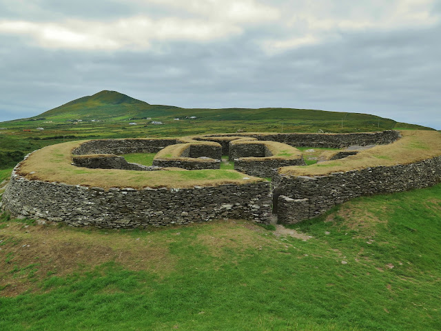
Leacanabuaile ringfort is the closest ringfort to the parking lot, Cahergal ringfort is 140 meters away, and Ballycarbery castle is located at the water's edge and within strolling distance. Walking to the ringforts passing by all the cows napping in the grass you got a sense that this scene was the same a thousand years ago. Leacanabuaile in Irish is "Leaca na Buaile" which means "summer cow pasture." Built high up on a rock ridge in the early 9th century, the fort was partly reconstructed when it was excavated in 1939. The archeologists found many Bronze age artifacts such as knives and whetstones, millstones and a variety of bone hairpins and combs.
 |
| Entrance to Leacanabuaile |
Approaching the massive 30-meter wide circle, you notice the entrance is in the East so that you are out of the blowing winds. The walls of this structure are thick; over 2 meters of flat drystone, built with steps on the inside so you can climb up to the top of the walls to survey the land. Inside there are remnants of 4 stone walled huts with post holes suggesting there was a wooden roof at some point. There are also large storage chambers built INSIDE the thick walls of the ringfort that can be accessed by underground passages called "souterrain." You can still squeeze into these passages today...if you dare!
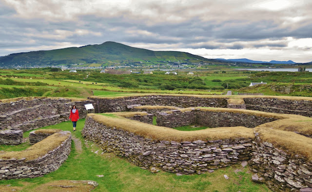 |
| Leacanabuaile Ringfort With Cahergal And Ballycarbery Castle In The Background |
 |
| Surveying The Landscape |
Walking through the windblown stone fort made me think of poor Sadhbh. She may have lived in this very house! Did she stand on top the stone walls of the fort watching the waters, waiting anxiously for her lover to return as so many past generations of Irish women did?
The Cahergal meaning "the bright stone fort" is older than Leacanabuaile fort, more restored (in the 1990s) and in my opinion not as exciting. It is closer to Ballycarbery castle and was built in 600 C.E., and the dry stone walls are an impressive 6 meters high and 3 meters thick! The builders did not use any mortar in these walls and were not kidding around when erecting this fort!
 |
| Ballycarberry Castle From Leacanabuaile |
A few hundred meters away from Cahergal stone ring fort is Ballycarbery Castle, perched right on the water's edge. The deserted castle tower is covered in ivy and looks quite forlorn next to the River Fertha. There is a local legend that says there is a souterrain that leads from Cahergal ringfort to Ballycarbery Castle.
The current structure dates back to the 15th century, but there was an older castle here built in 13th century on top of a yet older iron age ringfort. This part of the Iveragh Penninsula belonged to the O'Shea family, and one head of the O'Shea family was Cairbre O'Shea who built the original castle and where the name Ballycarbery came from; Bally=Bhaile=town + Carbery=Cairbre. The MacCarthy Mór was another powerful clan in the Middle Ages from Munster, and defeated the O'Shea's in the 14th century and took over Ballycarbery.
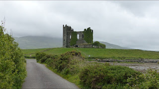 |
| Ballycarbery Castle Ruins |
To get to Ballycarbery castle you follow the same directions as to the ring forts, but you turn left off Castlequin Road at the sign to "Caisleán Bhaile Chairbre" which is Irish for Castle of the Village of Carbery. Follow the road to the water's edge where there is a little parking lot that locals use to go clamming. You can pull over here to get out and walk up the lane to take photos of the castle, but the land the site is on IS CLOSED TO THE PUBLIC.
The castle was severely damaged by Oliver Cromwell's army when they blasted through Ireland in 1652. Many of the rocks from the castle have been taken away and used to build houses and farm structures on the nearby farmlands. The castle is the biggest on the Iveragh Penninsula and has a long history, so it's a shame that the castle is not being preserved or even restored. Ballycarbery sits on private land, though the castle itself is owned by the government. The castle landowner has restricted the access to the castle in 2017, so we were not able to explore the ruins. I get it, they want to prevent further damage to the ruins and any accidents from people climbing up on the stonework; like the child that fell off the second story of the castle and badly hurt himself. So is it worth a trip to Ballycarbery? Let me put it this way: the castle looks good from afar but is far from good. Taking photos on a moonlight night or from nearby Ballycarbery Beach on a misty morning and you are living the photographer's dream.
 |
| Cute Little Guy looking For Cuddles |
The green hills of Cahirsiveen hold many legends, mysteries and ghosts. Exploring this spot lets your imagination run wild and connects you directly with the myths of an ancient people. Have you ever visited a place related to a myth? Tell me in the comments section below; I would love to hear from you!
Follow me on FACEBOOK, INSTAGRAM and BLOGLOVIN' for daily photos and updates! #slowtravel🐌 #dulgomall

No comments:
Post a Comment